Coleman McCormick

Archive of posts with tag 'Computer Vision'

February 8, 2024 • #

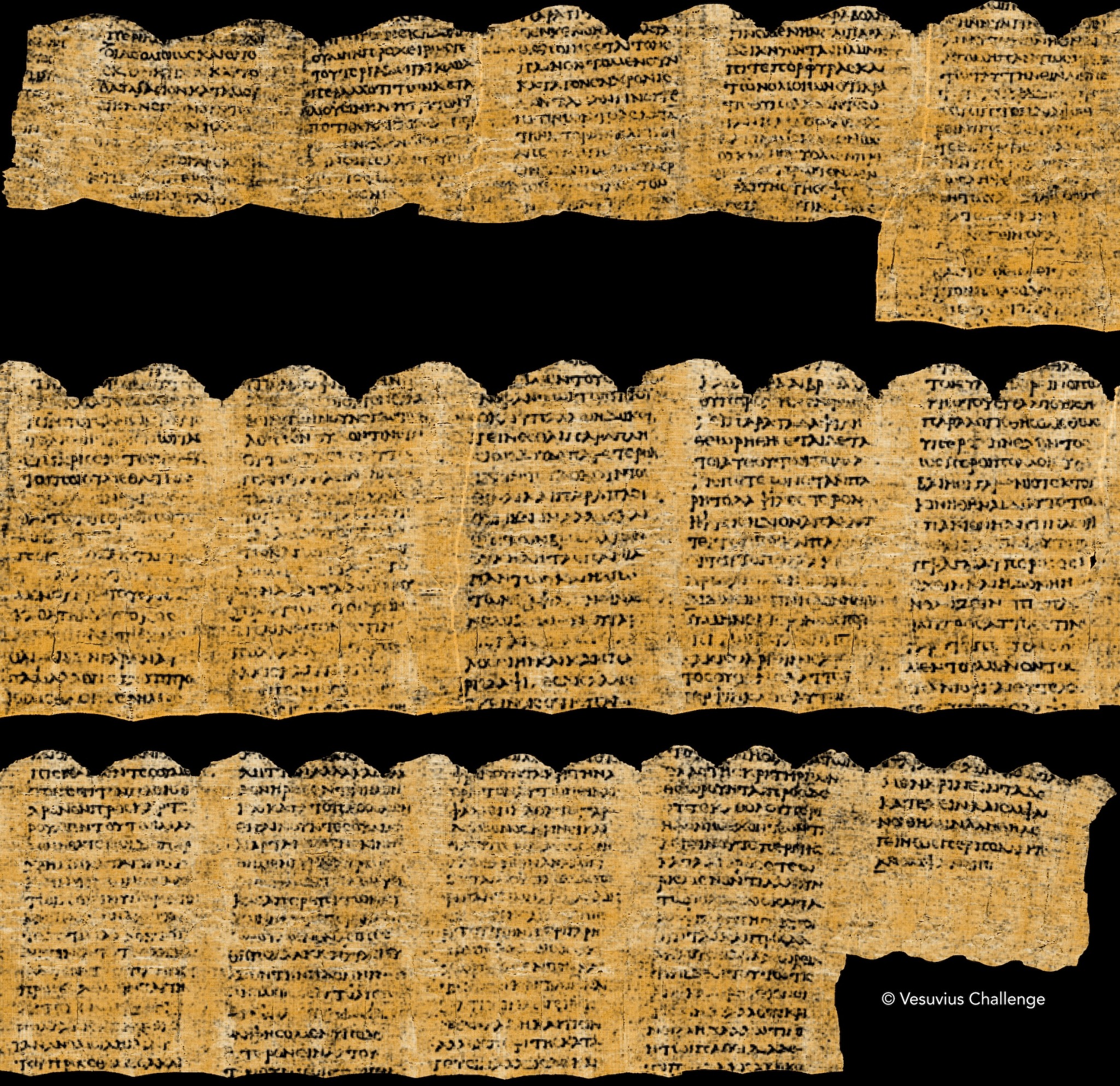
A group of researchers just won the Scroll Prize, a project to read the ancient Herculaneum papyri, burned and buried in the eruption of Vesuvius in 79 AD.

Using AI and computer vision techniques they were able to discern text from the rolled, charred, and brittle papyrus. An unbelievable feat.

Weekend Reading: The Hour of the State, Location AI, and Mapillary Acquired

June 20, 2020 • #

💬 The Hour of the State or Explosion From Below?

Martin Gurri is one of the best minds we have for the current moment. Make sure to subscribe to his essays on the Mercatus Center’s “The Bridge.”

The American people appear to be caught in the grip of a psychotic episode. Most of us are still sheltering in place, obsessed with the risk of viral infection, primly waiting for someone to give us permission to shake hands with our friends again. Meanwhile, online and on television, we watch, as in a dream, crowds of our fellow citizens thronging into the streets of our cities, raging at the police and the established order generally, with some engaged in arson, looting, and violence.

On one side, a reflexive obedience to authority. On the other, a near-absolute repudiation of the rules of the system—for some, of any restraint whatever. The future will be determined by the uncertain relationship between these two extremes.

🤖 DataRobot Location AI

My friend and former colleague Kevin Stofan wrote the launch post for DataRobot’s latest product additions for spatial AI. Pretty amazing additions to their platform.

🗺 Mapillary Joins Facebook

Good to see the Mapillary team add their computer vision tech and work with OpenStreetMap to Facebook. Big congrats to the team!

Weekend Reading: Universal Laws, Tandem, and Computers That Can See

August 3, 2019 • #

📚 Universal Laws of the World

A list of broad laws that apply to all fields. Thoughtful stuff as always from Morgan Housel:

6. Parkinson’s Law: Work expands to fill the time available for its completion.

In 1955 historian Cyril Parkinson wrote in The Economist:

IT is a commonplace observation that work expands so as to fill the time available for its completion. Thus, an elderly lady of leisure can spend the entire day in writing and despatching a postcard to her niece at Bognor Regis. An hour will be spent in finding the postcard, another in hunting for spectacles, half-an-hour in a search for the address, an hour and a quarter in composition, and twenty minutes in deciding whether or not to take an umbrella when going to the pillar-box in the next street. The total effort which would occupy a busy man for three minutes all told may in this fashion leave another person prostrate after a day of doubt, anxiety and toil.

His point was that resources can exceed needs without people noticing. The number of employees in an organization is not necessarily related to the amount of work that needs to be done in that organization. Workers will find something to do – or the appearance of doing something – regardless of what needs to be done.

💬 Tandem

This is a neat collaboration tool for distributed teams that just launched. It’s built on Slack and has integrations built for many of the common productivity tools that modern remote teams are familiar with. I’m keen to take a look at this for doing more real-time work with my remote co-workers.

👁 Computers That Can See

As computer vision continues its advance, machines are getting better and better at converting images and video into structured data. Computers have historically had sensor data feeds through text, binary data streams, and user inputs; eventually they’ll all have visual inputs, as well.

Weekend Reading: RoboSat, the State of Security, and the Equal Earth Map

January 12, 2019 • #

🛰 Buildings from Imagery with RoboSat

This excellent guide shows how to combine take imagery from OpenAerialMap and buildings from OpenStreetMap, and combine to train a model for automated feature extraction. It uses an open source tool from Mapbox called RoboSat combined to compare a GeoTIFF from OAM with a PBF extracts from OSM. Very cool to have a generalized tool for doing this with open data.

🔐 The State of Software Security in 2019

An excellent roundup (with tons of ancillary linked sources) on the state of various parts of computer security, from programming, to browsers, to social engineering.

🌍 The Equal Earth Map

From Tom Patterson, the Equal Earth map uses the equal earth projection to show countries with their true relative sizes. No more ginormous Russia or Africa-sized Greenland.