March 19, 2024 • #
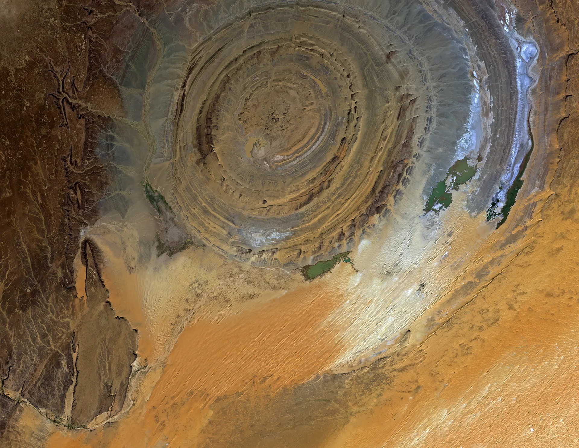
The Richat Structure in the Saharan Desert of Mauritania.
An eroded geologic dome.
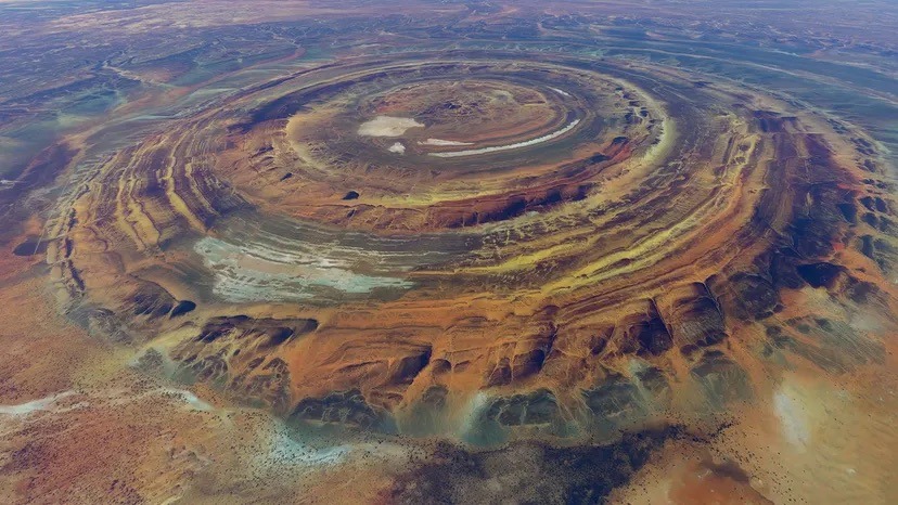
The Richat Structure in the Saharan Desert of Mauritania.
An eroded geologic dome.
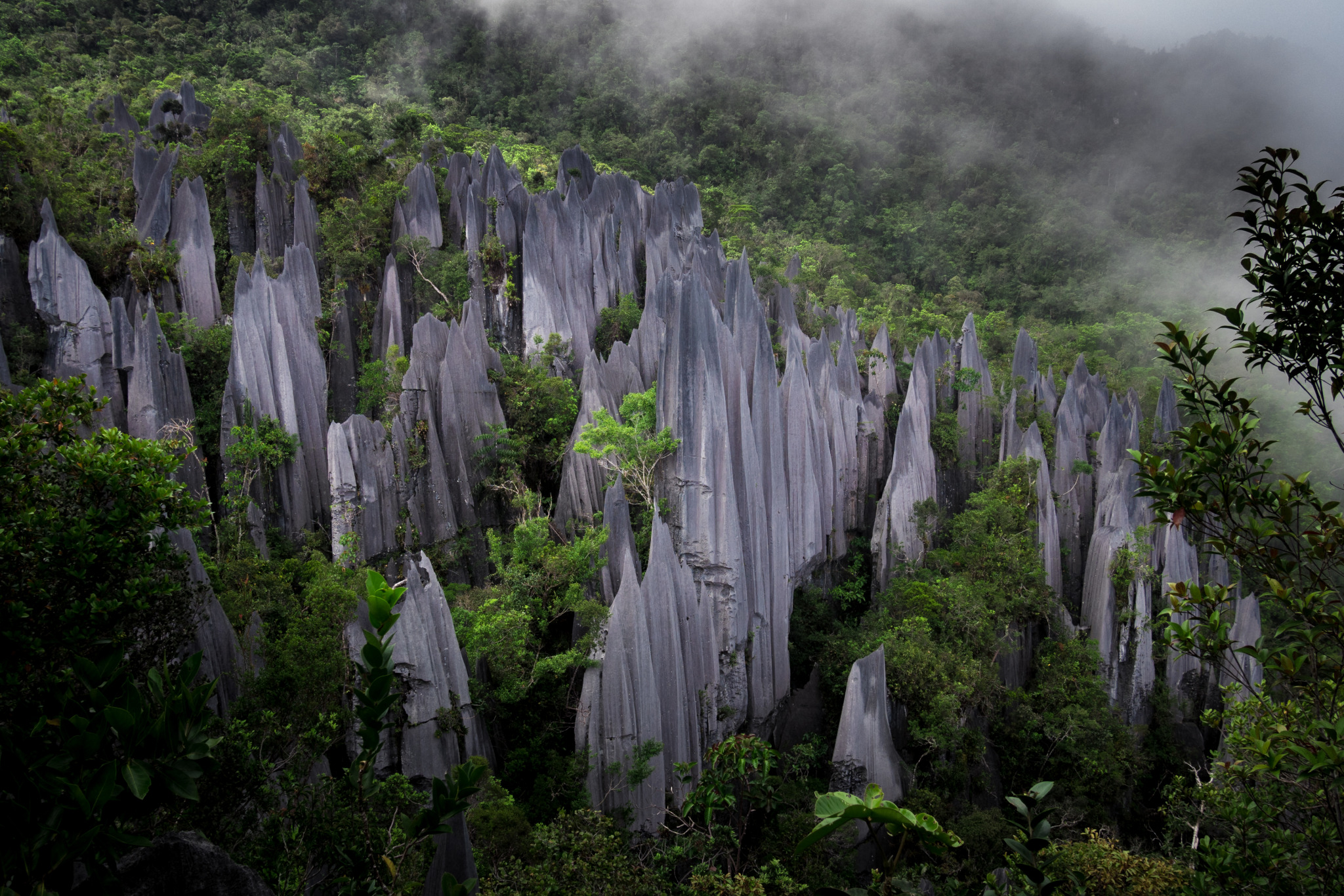
The karsting limestone of Mount Api , Malaysia.
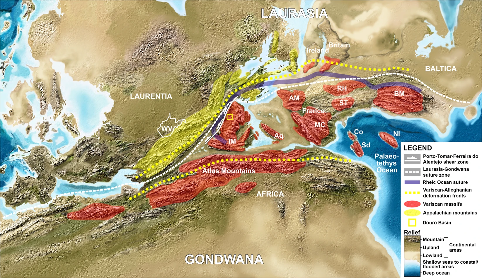
If you go back to the Permian, you’d find the Appalachians, Massif Central, Atlas Mountains, and Scottish Highlands were all part of a single range cutting through the Pangean supercontinent.
From John McPhee's 'Annals of the Former World'.
An eerie similarity between an ancient Finnish myth and a deep geological nuclear repository.
Superheated plumes of magma, hotspots, and the composition of the mantle.
Satellite data shows the expansive ancient shores of Lake Chad.
LiDAR, Auto Generated Textbooks, and Paleo Plate Tectonics
An interactive map to see what the Earth looked like in prehistoric time.
How we collect data at Spatial Networks, DJI maps the Camp Fire, and on mysterious geological records.
A review of John McPhee's book and resparking an interest in geology.
The state of Louisiana is gradually eroding, and a number of groups are using maps to highlight the gravity of the situation.